Transcripts
1. Introduction: [MUSIC] Have you ever looked at a beautiful landscape photograph
and thought to yourself, how did the photographer
find such a beautiful place to shoot at just the
perfect time of day? Or are you tired
of photographing the same old tourist
destinations, wondering how to find
new locations to create images that really stand
out from the crowd? Hey ya'll, my name is Meredith, and I am a naturalist
photographer and outdoor educator based
in Denver, Colorado. In this course, I'm
going to teach you how to find the best
locations to shoot landscape photographs
that nobody else has probably
ever captured before. We'll be exploring
the features and capabilities of two very
powerful software tools, Gaia GPS, and Google Earth. You will learn how to
use these tools to discover new and interesting
photo locations, as well as how to
evaluate the lighting, composition, and
accessibility of a location. We will delve into the advanced features
of Google Earth such as how to navigate through three-dimensional terrain
to plan your shots, and you will also learn
how to use Gaia GPS, an application that
will allow you to create and save custom maps, mark and organize waypoints, and navigate to your
desired location. We will cover
real-world examples of the trip planning
process using these tools so
that you can apply what you've learned in
multiple scenarios. This course is for anyone
who enjoys being outside and is interested in taking
landscape photographs, but it is especially geared towards hikers,
backpackers, cyclists, overlanders really anyone
who prefers to venture off the beaten path to
capture the perfect photo. By the end of this course, you'll have the skills
and knowledge of how to find unique
landscapes that are not as well
photographed giving you the opportunity to capture
something truly special. If you're ready to get started, then I will see you in
the very first lesson where you will learn some
of the core concepts about scouting and some of the
strategies that we'll be using throughout the
course to discover truly unique photo locations. Let's get started and I
will see you in the course.
2. Scouting basics: When I first started getting really into landscape
photography, the first thing I would
do to start looking for photo locations was I would go on apps and websites like Instagram and I'd search
through Google Images. I look at like blogs
and websites that had top 10 lists of top 10
places to shoot near, say, like Moab, Utah, or something like that. I would go to these
locations and I would end up with
really beautiful images. But I didn't like how what I shot looked like
everyone else's shot. But when you go to
these iconic locations, really stunning places,
say in national parks, photos that have almost
identical composition to everyone else who goes
out there to take photos, even when you're shooting these places under
perfect conditions, say you get the best
light and you're there, it's sunrise or sunset and all the conditions
are perfect. Even then, your photos still, they still look like
everyone else's. They still don't have
that unique aspect to them that makes someone say, wow, where is that? I quickly started
to get bored with this type of location scouting. I realized that I
was going to have to learn how to find new locations, new compositions, interesting locations that
no one had ever shot before, at least not a lot of people
had photographed before. What I found was one of the
best ways to do that is to spend more time hiking
day hiking, backpacking, even planning overland
trips in my truck to remote places that most
people have never put in the time or energy to go and photograph because
it does take a lot of extra research
and some extra work to find these interesting
places to photograph. But the reward for when you do find that perfect location, it's really worth all
of the time and energy, and effort that it takes. Later on, in this course, I'm going to teach you how to
plan these types of trips. But just know that you don't
have to be a backpacker or a hardcore outdoor
adventurer by any means in order to use the skills and techniques that
you're going to learn. Even if you want to do some car camping, some sightseeing, you'll still be able to use a lot of these techniques
throughout the course. Before we jump into
these techniques, Let's talk about the two most important things
that you need to consider when you're
scouting for a new location. The first is where and how to find a good
location to shoot. When you're searching
for a new location, you need to have in
the back of your mind an idea of what makes for a
good landscape photograph. Things like a strong foreground,
mid-ground background, an interesting subject like a mountain peak or
a beautiful lake. These are the types of
natural features that can make for a really
great location. Finding a great location also
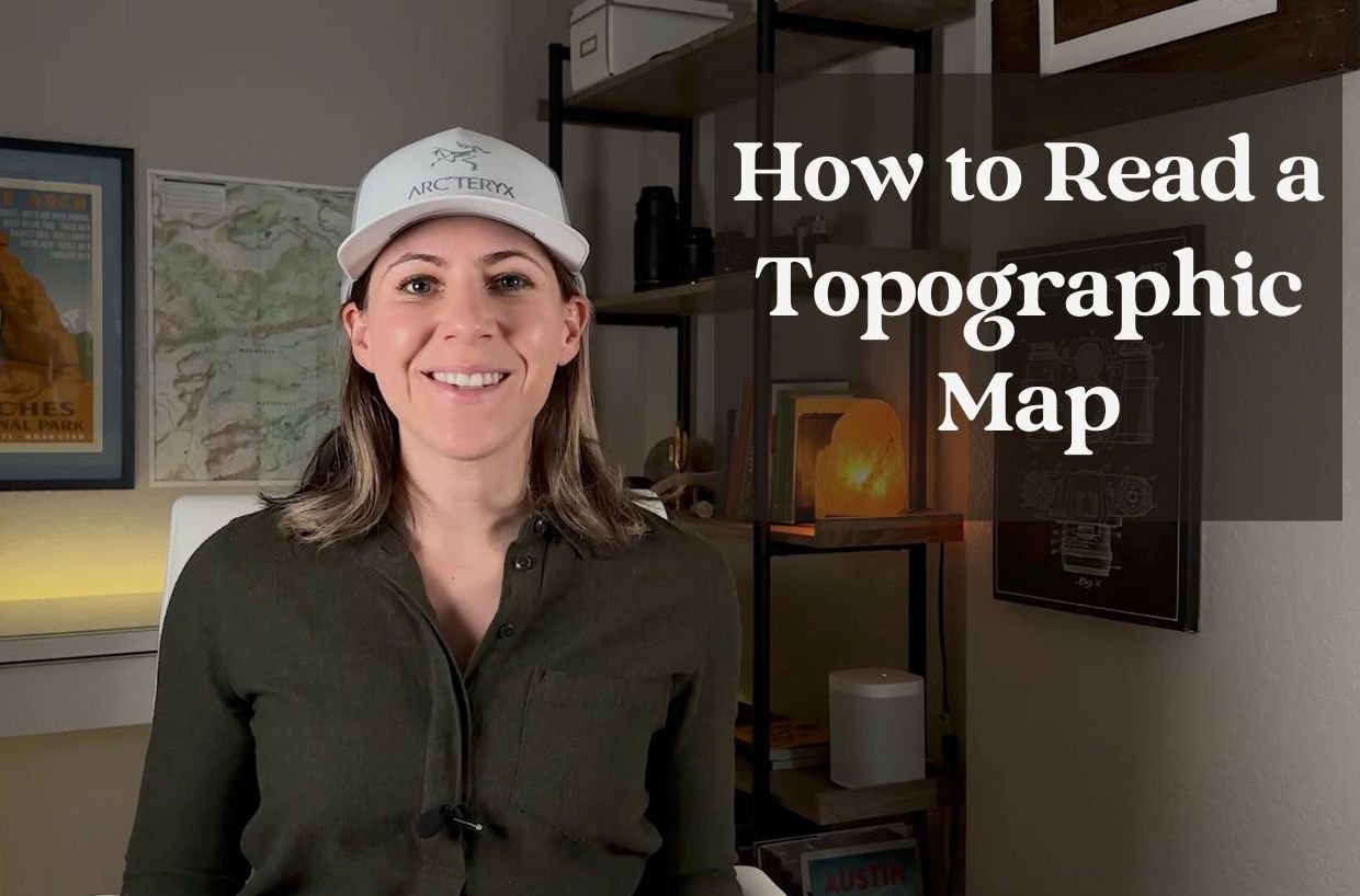
involves learning how to read maps, particularly
topographic maps. Learning how to understand and read a topographic
map or a topo map, in my opinion, is
probably one of the most underutilized skills
by landscape photographers. Later on, in this course, you'll be learning how
to use topo maps to better plan and find
photography locations. The second thing that's
really essential in planning a photography shoot is finding the best times of day
to shoot your subject. Once you find the
perfect place to shoot, it's really important
to understand how the lighting on the
landscape and the weather, and the seasons are all going
to affect your final image. The truth is that you can shoot a location 100 different
times and end up with 100 different
photos depending on the time of year and what the
weather is doing that day. Later on, in this course, I'll teach you some techniques
that will really help you out in predicting what the
light is going to look like. Generally, the best
times of day to shoot our early in the
morning around sunrise, and later in the evening, close to sunset
when the sun is low in the sky and close
to the horizon. This is when the light
appears softer and warmer, which will dramatically enhance the look of your
landscape photographs. Because the light has such a
beautiful warm color to it. An hour after sunrise and
an hour before sunset, we call this time
of day golden hour. Another great time of
day to shoot is called Blue hour and this is 30 minutes before sunrise
and 30 minutes after sunset. During this time,
the sky can turn a really beautiful
royal blue color and the clouds can light up in incredibly vibrant reds
and oranges, magentas. You can really
enhance the look of a landscape photograph
during these times of day. You'll also want to predict when the light will
hit your subject. For example, say you're
shooting a mountain peak, you'll want to know in
advance if sidelight will hit the peak or if it will be getting front light
or backlight. Since different types
of lighting can have very different effects
on your final image, Google Earth can be a really powerful tool to visualize how the light will hit your subject at
different times of day and even different
times of year. But first, before we
start using these tools, let's move on to
the next lesson, where we're going to
learn how to narrow down an area that
we want to explore.
3. How to narrow down locations for a great photo spot: Before we jump into scouting, it's a good idea to
narrow it down to the general area that we
want to explore first. Later in this course,
you'll be seeing a lot of trip
planning and scouting examples in places that I personally explore like
Colorado and Utah. But I want you to
start thinking about places that you might
want to explore, places close to your
home or maybe on your next photography trip
so that you can start applying the tools
that you'll learn about later in this course. To help you brainstorm
about where you want to start scouting, here's some advice I have for
narrowing down a location. The first tip I
have for you is to research popular
photography locations. There are certain
locations that are well-known for how
photogenic they are. Places like national parks and state parks and iconic,
perhaps touristy places. I recommend that you do
your initial research on apps and websites
like Instagram, 500px, and Flickr, and find out where other photographers
have been shooting. Once you have a general idea
of where you want to go, then you can start using the
strategies we'll be using in this course to narrow it down
to more unique locations. The next tip I have
for you is to consider the seasons in the area that you're considering
to explore. In certain areas, different
seasons can offer different opportunities
for landscape photographs. For example, autumn is a really great
time to photograph the change in colors
of the leaves. Especially in places like
New England and in Colorado, when the Aspen leaves start
to turn yellow and gold, winter has a really
different look and can provide stunning
snow-covered landscapes. Spring and summer think about
when the flowers bloom, this can add a lot of
interest to your photographs. I encourage you to think
about what type of senior trying to capture and then
plan your trip around that. Along those lines, consider how practical it is going to be to travel to these places during the seasons that
you want to shoot. You don't want to
go to the desert in the summer when it's 120 degrees outside plus and you also don't want to go to
Colorado in the winter, at least not if you're
planning a backpacking trip. The third tip I have for
you is to think about the accessibility
of the location that you want to explore. Consider how easy or difficult
it will be to get to a location and whether you need special equipment
or special permits. If you want to go
somewhere in the winter, do you need snow shoes or ice climbing gear or
mountaineering gear? What is it that
you're going to need and how accessible is that
location going to be? This is another
factor to keep in mind when you're narrowing down the specific area that you want to delve into and
research further. Once you've narrowed it down to a general area that
you want to explore. In this next lesson, we're going to jump into
the really fun stuff. We're going to start
to learn how to use Google Earth
to brainstorm and visualize new and interesting
locations to photograph.
4. How to setup and use Google Earth: In this lesson, you're going to learn how to use Google Earth, which is one of the
most powerful tools in discovering new locations and planning your photography trips. It's a really great tool, especially when you're in the brainstorming
phase of planning your trip because you can
get both an aerial view of the area that you want to start scouting and you can also get on the ground level so you can get into a location almost
as if you were there, at least as close as you can
get without actually being there and see what the landscape
is going to look like. Not only that, but
you can also see what the light is going to
look on the landscape, so this is a really invaluable
tool when you're getting some ideas and
you're starting to plan new and
interesting locations, places that might have potential like mountain peaks, lakes. You can really get right up close to these places without, again, like I said, not
having to be there. Let's jump in to Google
Earth and see how it works. The first thing you're
going to want to do is download the desktop version of Google Earth and I will leave a link in the course description of where to download this, but it's very simple. It's just
google.com/earth/versions. Once you get to this page, you'll see a few options. You will want to click on
Google Earth Pro on desktop. There is a great web version that you can use
through your browser, but for the purposes
of this course, you're going to want to download the app to your desktop, so click on this. You'll come down here and again, click Download Earth Pro, and accept and download. Once you go through the
prompts, meet me back here, pause this video and we'll
continue with the lesson. Once you have Google
Earth downloaded, go ahead and open
up the application. You should have something
that looks like this come up just a floating
earth in space. The first thing we're
going to do is go through the preferences that
you'll want to have set. Come up to the top bar here, click on Google Earth Pro, come down to Preferences and rather than going
through each one of these preferences separately, go ahead and copy these
preferences that I have here. What you see here, I found to be the
best settings to use Google Earth for scouting
and things like that, so pause the video here and copy these preferences
and meet me back. Once you have these
preferences set, you'll see these other
tabs at the top here. Don't worry too
much about these. Keep them as they are. They are right out of the
box with Google Earth, so cache, keep the same. Touring, you'll keep the same. Navigation stays the
same and general, all stays the same
and we'll click Okay. Once you have the
preferences set, the first things first,
let's zoom in on a location. This could be literally
anything on earth. I'm going to zoom into Rocky
Mountain National Park, which is a beautiful
scenic national park near where I live in
Denver, Colorado. Search for that, and
application will zoom right in to
that spot on Earth. The next thing we're
going to do is look at this panel on the left, these settings on the left. If your panel isn't showing
this button right here, we'll open and
close that sidebar, so go ahead and open that
up if it's not already. I'm going to close this search and don't worry about this. We're going to come
right down to layers, and this is just information that's layered on
top of the map. I only use three of
these layers here. First, I use borders and labels. This, as the name suggests, is showing all of the
labels on the map, will help you find locations. Places, I keep checked. Everything else here I
do not keep checked. I don't find the
need to show roads, buildings, especially for
landscape photography. I use separate app for weather and I keep
terrain checked. You definitely want to
have terrain checked. This is what's going to give your map three-dimensions as
we'll see in a few minutes. The other thing is
sometimes I use, you click More, here. It will show you outlines of
trails and major roads here, as well as trail heads, things like picnic locations and this can be
useful sometimes. I mostly have this turned off, but it can come in handy. We've got layers set. Now, the next thing
we're going to do is start to zoom in on the map. There's a variety of keyboard
shortcuts that you can use to move through the
Google Earth application. I'll provide a link to all of the keyboard shortcuts in the project description
and mention them as we move through here in
order to start zooming into this map and get more
detailed information about the landscape. The easiest way to do that is to zoom by scrolling
with your mouse, so in order to zoom in, I will scroll in
using my mouse just to scroll and you
can see we dropped right down into the
landscape here. If you want to zoom out, you do the opposite, so you can scroll out and the
map will move away from you and you can get as far as
you'd like all the way back out to seeing the entirety
of Earth from space. We'll, zoom back in here, and let's say we want to move our location around Rocky
Mountain National Park. All you need to do is click
down on your mouse and drag. As you drag, you start to move yourself across the landscape and sometimes it's
helpful to zoom out in order to see
really what's going on, but again, let's zoom back
in here to Tombstone Ridge. The great thing about
Google Earth is you get this aerial view, but you can also use Zoom in all the way to the point
that you want to stand on. You get to earth level
or ground level view. Once you get to ground level, you can simply pan
back and forth just by clicking and dragging. You can see right
away how this is an incredibly
powerful tool to see what you'd be looking at if
you did a hike in the area. Say we hiked all the
way to Tombstone Ridge, this is what the landscape
would look like. If you want to exit ground view, you just click that button. The other thing that
is extremely helpful to navigate around
Google Earth is to click the command
button if you're on a Mac or control
if you're on a PC. Then while you're
holding Command or Control, click and drag. This will give you the
ability to pan up and down, as well as side to side
from any vantage point. Now, this is something
that you're going to have to experiment and spend some time playing
around with this. You'll pick it up
pretty quickly, but it does take a few minutes
to figure out how to use these keyboard shortcuts and to navigate your way
around through space. Again, holding Command or Control and then
clicking and dragging, you'll be able to move in
literally any direction here. Now let's come up to view and there's some really
useful tools up here. The first one I want
to mention is the sun. When you click on this, you're going to see what
the sun will look like, what the light will look
like on the landscape throughout the day and you
can even pick the date, which is useful because the sun is going to
change over the course. The angle in the sky and
the location is going to change throughout the
course of the year. Here you can even see the
Milky Way moving through. Again, really great
for planning. This is something
that I keep off most of the time unless I find a location that I
want to explore more and to see what the
light is going to look like. This, for example, is an incredible location. Once we get to sunrise, close to 07:00 AM, we see some really
nice side light hitting this peak right here, which is Long's Peak, that's over 14,000-foot peak, so really stunning landscape out here in the Rocky Mountains. The easiest way to close
this and to turn it on is to click this button here with the sun in the mountains so you can go toggle back and forth and quickly move
in and out that way. We'll come up here. Other
settings that I have selected. Keep water surface on. Sometimes you might want
to click on atmosphere. This will give it more realistic
look to the landscape, so you can see during the day how this changes the look of the
light on the landscape. I usually have this setting
turned off because it adds a hazy look and I don't find that it adds much
value when scouting, so go ahead and
experiment with this. Find a location
literally anywhere on Earth and just do
a little scouting. Practice moving around, finding different vantage points
zooming in and out. The other thing I
should mention here is when you're navigating
through space, it can be useful
to reset to North. You can use these tools up here. Again, play around with these. If you find yourself
a bit disoriented, you can click N up
here and it will position the map to the North. You can use these
toggles to move around. Keyboard shortcuts and
your mouse are going to be a lot easier than using this, so this can be great to start, but once you start
using this more, start using those
keyboard shortcuts. That's about it for
now for Google Earth. In the next lessons, we'll talk about how
to integrate this with another powerful application
called Gaia GPS.
5. How to export a route from Gaia to Google Earth: [MUSIC] In this
lesson, we're going to learn how to take the route that we've created and
export it to Google Earth, so that we can start to get a clearer picture of what our hike is
going to look like, and what the landscape
is going to look like at our desired
photo location. Once you've created
and saved your hike, come down to the
bottom here to Export. You'll get a series of options. The one that you need to click on in order to open this using Google Earth is the KML option. The GPX is the option
that you would use, if you wanted to upload
your route to, say, like a GPS device, or a Garmin watch, a GPS watch. But for Google Earth
we'll click on KML, and this will immediately
download it to your computer. Once it downloads,
you can click on it, and Google Earth should
automatically open up. This is a really cool part. We're going to drop right down onto the route that
we just created. You can see Dream
Lake right over here, and our Bear Lake
Trailhead parking lot, which we can zoom into here. I can start to see what this
area is going to look like. Keep in mind, we never have
to step foot in this location to really get a good idea of what it looks like
and what's going on. We can almost visualize what the hike is
going to look like. You can see as we turn
towards Dream Lake, this incredibly dramatic
landscape starts to appear. We'll work our way
through this hike. We can see right here is
where our photo spot is. That is where the end of the
route that we created is. If we come down all
the way to this spot. Sometimes when people have
taken images of a location, the ground view or Street
View will be a photograph. Let's go ahead and exit that, because we really want to see what Google
Earth looks like. We can reorient ourselves. This would be very close to what the final composition
would look like, and then we can
start to add in what the lighting would look like. I'll go ahead and turn
on Atmosphere here. Let's check out what sunrise. We have blue hour,
just before sunrise. You can see right after
sunrise during golden hour, this peak is going to light up this flat top peak
and we're going to get some really nice, beautiful golden light likely, if the clouds cooperate. That is how you put together
Gaia GPS and Google Earth to create a hike to a
really amazing photo spot. In the next few lessons, we'll go over some more examples of how to go through
this workflow, this trip planning process using Gaia GPS and Google Earth. We'll go through some different
scenarios and landscape, so you can start to get a
better idea of how to apply this in the location that you choose to go and
scout and explore.
6. Lesson on Overlays Gaia GPS: The first thing you'll do to
get started with Gaia GPS is go to gaiagps.com. Again, I'll link this website
in the course description. But once you get to the site, I'll scroll down just
a little bit here and you're going to want to
choose one of these plans. I highly recommend
the Gaia GPS premium. If you are a hiker, backpacker, even if you
do overland and cycling, things like that in
landscape photography, this is a really
amazing app to have. Now, if you're not ready
to jump into premium, the free version
is great as well, and you can still get
a lot out of this. You can still use this for the purposes of this
lesson but in order to get all of the features that we'll go throughout this course, Gaia GPS premium is which
you'll want to sign up for. After you sign up for either a free or paid account
with Gaia GPS, go ahead and log in. The first place,
you'll be taken is to a page that shows you a map, as well as this side
panel on the left here. It's likely going to
be a different map. But we're going to
hop back over to Rocky Mountain
National Park where we were in the previous lesson. If you come up here, again, type in where
we want to go. Click on that and we
are immediately taken to a map of Rocky
Mountain National Park. I'm going to zoom in
here and as you can see, the map is getting more
and more detailed. What we're looking at here
is called a topographic map. If you have no idea what topographic maps
are, that's okay. But I do want to mention
that knowing how to read and understand topographic maps is a really important skill
for landscape photography, for hiking, backpacking really any type of outdoor adventure. It's going to be
really important as we move through
the lessons to understand a topographic map and to use Gaia GPS in general. The next thing we're going
to do is come over to this left-hand side panel
and click on "Overlays". Now, this is data that's
going to be layered onto your base topo map here. We'll talk about what each
one of these things mean. First, waypoints. A waypoint is just a
single location on the map and you can create these waypoints in this
create section here. If you click on "Waypoint", you'll see this
little marker pop up. This is just indicating
again a single point on the map and we can move
this wherever we like. Now let's say when
we're scouting, we find a really great
location on the top of Gabletop mountain
and what you can do is drop that pin there
and name this location, whatever you want to name it, customize it,
changing the color. You can add a little icon indicating that
it's a photo spot. This right here are
the GPS coordinates. When you're out hiking, so you need to find
this exact spot, you can use these GPS coordinates
to find this location. Here we've got the elevation, so quite high,
almost 12,000 feet. Now when we come back
to overlays right here, after we've made our waypoint. This little toggle right here
turns the layer on and off. If you click on this
toggle and turn it off, you'll see that our
waypoint has been hidden. Typically, I keep this
turned on most of the time. Right here you can turn
on your waypoint labels. Whatever you named
your waypoint, here we named it great photo
spot that will show up. Typically, I'll keep this off. I don't find it necessary. Moving on to routes. Routes are trails that you record manually using
the Gaia GPS app. To show you an example
of what that means, and we'll go into this a lot
deeper in later lessons. But to create a route, we click on "Create" route. We look at the trails on the map and pick one that
we want to record. Let's say we want to hike
to this lake right here, and pretend that our trail
head starts right here. If we click on this trail, we can drag this
route tool along the trail all the
way to our lake. What this is showing you is a recorded route
through Gaia GPS. It shows you all great things like how far you
have to climb up, how much you go down, the elevations, gives you
a full elevation profile. Let's save this route so I
can show you in the overlays. I'm going to save that here, go back to overlays. When you go to this route's
toggle and turn this off, the route will disappear. Generally I keep this turned on. Now, if we want to say we
don't need this route, we can click on it and click "Archive'
and it will disappear. Same thing for this
waypoint here. Let's come back to overlays, I'm going to keep routes on. Tracks are similar to routes, but they are created
in the field. When you have a tracking device
like a GPS, a GPS watch, or your phone and let's say you track your hike
while you're out on a hike, you can upload the data
from your GPS device onto Gaia GPS and it will appear just like the
route will appear. It'll look, say we did that same hike and recorded
it on our GPS watch, we could see it on the map. I don't have any uploaded
onto my map here, but it would look the same. I'm going to turn this off
because we don't need that. Areas. Areas are like
routes and waypoints, but you can capture area. As an example here, we can click on the map
and draw out a shape. This isn't something that
I find useful for hiking and photography and
especially the things that we're covering
in this course. We're not going to use areas, but it's just something good
to know that it's there. We'll turn that off. Public tracks. If
we turn this on, we can see public tracks are, when someone goes out
and records a track, they can upload it to Gaia
GPS and then make it public. All of these tracks that you see here were created
by other people, uploading them to the program and they are available
for everyone to see. You can click on one of these and see what people have done. This is great to get ideas for new hikes and
things like that. Not something that I really use, and we're not going
to be using in this course so we're
going to turn that off. Save trails. These are trails that you can find through the trail database. For example, say someone
records a public track. You can click on that track
and you can save this. Copy to my tracks
and it will save to your Gaia GPS account. This also isn't something
that we're going to be using, so let's turn both of those off. Finally, grid overlay. This is showing you
the lines of latitude and longitude for different
coordinate systems. This is not something
that we're going to need. This is something I never use, so we're going to keep
that turned off as well. That's it for overlays. In the next lesson, we're going to be talking
about layers over here. This is something
we'll use to see even more information
about the landscape in planning our landscape
photography shoots. Stay tuned and we'll
be right back.
7. Layers lesson Gaia GPS: [MUSIC]. In this lesson,
you're going to learn how to use layers in Gaia GPS. This is where the real fun
starts when using this app. Let's head over to Layers and you'll see this
layers panel open up. When you first start using Gaia, you're probably not
going to see any layers listed here under the
hidden layer section, we'll start to add these
layers in in a moment, but to understand
what a layer is, think of it like
a map that shows something specific
about the landscape. These are maps that
we're going to layer on top of our base map here, our base topo map that we've been using in
previous lessons. Layers can show us really useful information
about the landscape, things like snow depth, how deep the snow
is going to be. This can show us if a
trail is accessible. It can show us whether
land is public or private, where wilderness areas are. It can show us if there's
wildfires in the area. This can be helpful if you want to know if
there's going to be heavy smoke that can impact the way a photograph
is going to look. Cell phone coverage,
even light pollution, if you're shooting
night sky photography and you need really
low light pollution. If you're a science
nerd like me, there's even a geology
layer so you can see what types of rocks that you're seeing and hiking on throughout your hike. Lots of really cool
interesting things, and this really just
scratches the surface of all the types of layers that
you can use in Gaia GPS. Let's start adding in
some of these map layers. The first thing you're
going to want to do is come down to this, add more layers. In first-year going to select where you want to go hiking. I'm in the United States, so I'm going to click on the US, and here you see a whole
list of topographic maps. You're probably
not going to need or use all of these maps. The ones that I do recommend are the Nat Geo Trails Illustrated and you can add these just
by pressing the plus button. I've already added this
to my collection of layers and I'd also
add the USGS topo map. You'll find that
different topo maps, even of the exact same area, can have variations and
information that they show. It's good to add
different topo maps, so when you are
planning your trip, you can see all of the
information layered at once. Again, this will make more sense as we work through this process. Once you add the topo
maps that you want, we'll go back again, come down here to
add map layers. This time, we'll go
to satellite imagery. These are maps that show imagery from satellites and
the ones that I highly recommend are the fresh set Cloud-free and the
fresh that recent. As I'll show you a little
bit later in the lesson, these show recent images taken
from satellites and this allows you to see all interesting things such
as when the leaves change, they are in an area where
fall foliage can occur, areas where you might
want to hike and you want to know if there's
still snow on the ground, that's where recent satellite
imagery can be very useful. Let's close this up and
come down to topo maps. This is another collection of topo maps that really
cover the entire earth. The only one that
I use here that I recommend is the Gaia topo, which is what I use
for my base map. We'll close this up. Roadmaps, I do not use roadmaps. It's something that Google
Maps really takes care of for me when I'm out hiking
roadmaps are not necessary. Feature and whether overlays, lot of good stuff here. Again, this is something if
you're interested in geology, I would definitely add
to your layer list. Cell coverage, I have verizon, this will show you if
you get cell coverage, even when you're out
in the backcountry, sometimes you can still
get cell coverage, so you want to know if you'll
be able to reach contacts, say like an emergency contact with your cell phone
this can be useful. Light pollution if you're doing night sky photography,
very useful. You can go through these,
experiment with them. Everyone's going to
use different layers, but for the most part, the ones that I have shown are so far,
the most practical. Slope angle I would
definitely add as well as shaded relief. If you live or exploring
an area with snow, definitely add snow depth, and these other ones
are really optional. For now, let's go ahead
and close this up. US hunting overlays,
if you're a hunter, can be really
practical again, guys, for so many different
types of adventures, but for our purposes, we're not going
to be using that. Same for nautical and aviation, we won't be using that. When you go back here, all of the layers that
you've just added will start to populate under hidden layers. In order to add one of your hidden layers into your
visible layers so that you can actually see the layer you click right on
this circle here, so I'm going to start
with shaded relief. Shaded relief is a really
great layer to show you a three-dimensional
perspective of what your topo map looks like. You can see when I added
this shaded relief layer, it completely covered
the topo map, and the thing is, it's really important to see both the topo map in
the shaded relief map. What you can do is you
can change the opacity of the layer by moving this like so if you
bring this backdown, it's going to make this
layer more see-through so you can start to see
the topo map below. It's really important
to point out here that the order of
your layers matter. The layer that you have on top is going to be the most visible, as you work your way
down your layer list, each layer is going
to be layered on top of the one below it. Let me show you an example here. Let's pull this one
all the way back up and let's pick our
geology one, just for fun. This geology map has completely hidden
the shaded relief below it or mostly hidden. As we pull this down, we can start to see the layers below and if we
pull this one down, you can start to see the topo map all the way at the bottom. If we add in our fresh sat layer and let's zoom out here so
we can get a better look. We're not seeing anything
really because the clouds were obstructing the satellite
when it took these images. If we remove that layer, once we uncheck that, it'll go back to hidden layers. Let's check fresh
sat cloud-free. That will populate
up here and this is the most recent satellite image taken without clouds
obstructing the videos, you can see that came out
a little bit more clear. There's a lot of snow
on the ground right now it's the middle of January, so we can just assume that everything here is
covered in snow, likely in deep snow, and if we want to
see how much snow, that is, let's click
on our Snow depth. Zoom out here a bit. We see a map of
the snow depth and this right now it's not
really making any sense. We see a lot of
different colors. What you can do if you click
on this icon right here, this will give you a key
to the map and this goes for all of these layers. For example, the geology layer, if we click on that, we can see a key indicating what all of the colors
mean on our geology map. Going back to the snow depth, we can see that as we get
closer towards the red, the snow is getting really
deep and if we zoom out, this will start to make
a little bit more sense. You can see that the snow as we get away from
the mountains, so the east here is
more flat planes. The mountains up
here to the west is where the snow starts
to get really deep. As we get into this
magenta color here, snows up to 200 inches, so let's jump back over
to our layers panel. Let's pull the opacity
down just a bit. We can start to paint
a picture of all of this different information
of the map we're looking at layered one
on top of the other. Sometimes having more than
three or four layers, it becomes too much, so I'm going to remove
some of these layers here and we'll zoom right back into Rocky
Mountain National Park. That is a general overview of
how to use layers in Gaia. I encourage you to go
experiment with this stuff. Go find some layers that
look interesting to you. Look at the keys, zoom in and out, change the opacity,
show and hide them in different ways and you'll quickly pick up how to use this. In the next lesson, we'll start putting
all of this together, combining Google
Earth, Gaia, layers, overlays all of the things
we've learned so far into a example of how to
plan a photography shoot. I will see you back here.
8. How to design a route in Gaia GPS to a great photo spot: [MUSIC] Welcome back.
In this lesson, we're going to learn
how to combine all of the skills that we've learned so far in the course, using GAIA GPS and
Google Earth to design our own hike to
a photography location. We are back in Rocky
Mountain National Park. We're going to start by zooming in on this
part of the park. This is an area that is filled with really incredible
photography spots. It's a location with
lots of glacial valleys, cirques, stunning jagged peaks. I want to let you know that
throughout this course, I'm going to be showing
you very popular areas. This is a really highly
trafficked tourist area. There's quite a lot of
people who visit this area. I say that because I want
you to know that I'm not revealing sensitive
wilderness areas because that's something
to keep in mind when you are making your maps and
your photo locations public is to consider how sensitive the ecosystem
is and to not share, especially online or through social media where these
photo locations are. Because a lot of times
ecosystems can't handle an influx of recreation and tourists in a really short
amount of time especially. Just keeping that in mind. We're going to zoom in here to a photo location right
at the edge of Dream Lake. Right about this spot, this is a very famous
place to photograph Dream Lake with Hallett Peak
in the background here. If we move over this way, Hallett Peak right here and Flattop mountain is
to the right there. This glacial valley fills the entire view of the photograph with the
lake in the foreground. Like I said, it's
really stunning. In order to start
designing our hike, we're going to look
for the nearest parking lot and trail head. If we look over here, we can see this is one of the main roads in the
park and it leads in to this Bear Lake area. This is a parking
lot right in here. We're going to plan
on starting our hike right from the parking lot at
this Bear Lake trail head. The route that we're going to take straight from the
trail head will come up Nymph Lake trail then come
around this trail up top here, all the way to Dream Lake. When you're planning
your photography shoot there's two things
that you'll want to know when you start
to plan your hike. The first is how far is the
point from the parking lot? From here all the way
to the photo location. The second one is how
much elevation gain is there going to be from the parking lot to
our photo location? These two things are really going to affect
how long it takes to get to that photo
spot and that will affect how we time our hike. I know from scouting
using Google Earth, that this particular photo
location is best at sunrise. That's when the most
dramatic light is going to hit Hallett Peak
and Flattop Peak. We want to time our hike so that we leave the
parking lot with enough time to get to
our photo location and factor in how long it's going to take
to hike this distance, as we'll figure out in a minute, just how far that is
and how difficult, how strenuous that
hikes going to be by how much we have to hike up. The first thing we'll do here is we'll start to
create a route. Come back over here to your
panel, click on "Route". In order to start the route
place the crosshairs where your mouse is directly on the trail head and just
click on the trail head. You could potentially
click anywhere you like to start your trail, but we're just going
to start right at the trail head because
that's where we parked. You'll see as you drag your mouse along the trail
that you want to hike, the blue line or the
route that we're creating will automatically
start to snap to the trail. Sometimes it has
a little trouble determining which trail that
you want it to snap too, especially if you start to pull your mouse out pretty far. Here it's doing a
pretty good job. We will keep going
here move over to the left just to get a
little bit closer to the lake. Let's keep dragging out here and see how it popped
to the other side. That can happen and the
way to avoid it is to, instead of trying to
drag your route out all the way to your
destination at once, I simply do it in increments. Once you see that it's
sticking properly, just go ahead and click on the trail just like
that and you'll create another point along
the trail that'll tell GAIA to stick
to that trail. It won't start to jump back
and forth to other trails. We'll keep clicking
here along the route. Here we've made it to our
final photography location. You'll see over here
in the left-hand panel that the distance
from the trail head, as well as the amount
of climbing the ascent, this is the overall
distance that you will be hiking vertically is
listed over here. These are the really
important numbers that will help you
in determining how long it will take to
get out to your photo spot. The other thing to
keep in mind here, you'll notice that the elevation is shown on the map as well. This is quite high. If you're hiking up at altitude, you should also keep in mind that it's going
to likely take you a little bit or even a lot longer to get to
your destination, especially if you're
coming from sea level. Just something to keep in mind as you're planning your hike. One way to determine
how long it will take to get to
this photo spot is to go out somewhere with
all your camera gear on and walk around
your neighborhood, time yourself, how long it takes to get three-quarters of a mile. In order to complete our route, we will start to drag our route creator. Is
not going to work there. In this example, when I clicked back on the route to head
back to the parking lot, it did not do a good job
sticking to the trail. You can click on this route point and then simply delete
it just like that. Let's see if we will do a
better job coming back here. You can see how this can
get a little bit tricky. Let's make our way back
to the parking lot. You can double-click there. We've completed our route. Our total distance is a
mile and about a third. We climbed basically the
whole way to the lake. Everything on the way back was mostly downhill
because we didn't have really much change in assent from getting
up to the lake. We have our hike. We'll come
down here and well first, let's name our hike and click "Save". Now our hike has been saved to your GAIA GPS account
and you can come back to it whenever you
want to reference it. It will also be available
on the GAIA GPS app, which you can download
to your phone and then take out with
you on your hike. You can even download maps
for offline use to help you navigate to your photo location and ensure that you
don't get lost. Those are the basics of
designing your own hike. It's quite simple once
you get the hang of it. You can use this method not just for hiking
and backpacking, but as we'll see later, it works for scenic
drives, over landing. If trail runners,
mountain biking, this is something that
you can incorporate into planning all types of
photography trips.
9. How to export a route from Gaia GPS to Google Earth: [MUSIC] In this lesson,
we're going to learn how to take the route that we've created and export it to Google Earth so that we can start to get a clearer picture of what our hike is going
to look like and what the landscape is
going to look like at our desired photo location. Once you've created
and saved your hike, come down to the
bottom here to export. You'll get a series of options. The one that you need to click on in order to open this using Google Earth is the KML option. The GPX is the option
that you would use if you wanted to upload
your route to say, like a GPS device or a
Garmin watch, a GPS watch. But for Google,
Earth we'll click on KML and this will immediately download
it to your computer. Once it downloads,
you can click on it and Google Earth should
automatically open up. This is a really cool part. We're going to drop right down onto the route that
we just created. So you can see Dream
Lake right over here and our Bear Lake
Trailhead parking lot, which we can zoom into here, we can start to see what this
area is going to look like. Keep in mind, we never have
to step foot in this location to really get a good idea of what it looks like
and what's going on. We can almost visualize what the hike is
going to look like. We can see, as we turn
towards Dream Lake, this incredibly dramatic
landscape starts to appear. We'll work our way
through this hike. We can see right here is
where our photo spot is. That is where the end of the
route that we created is. So if we come down all
the way to this spot, and sometimes when people have taken images of a location, the ground view or street
view will be a photograph. So let's go ahead and
exit that because we really want to see what
Google Earth looks like. So we can reorient ourselves. This would be very close to what the final composition
would look like. Then we can start to add in what the lighting
would look like. I'll go ahead and turn
on atmosphere here. Let's check out what sunrise, so we have blue hour
just before sunrise. We can see right after
sunrise during golden hour, this peak is going to light
up this flat top peak, and we're going to
get some really nice, beautiful golden light likely
if the clouds cooperate. That is how you put
together Gaia GPS and Google Earth to create a hike to a really
amazing photo spot. In the next few lessons, we'll go over some more examples of how to go through
this workflow, this trip planning process using Gaia GPS and Google Earth. We'll go through some different scenarios and landscapes, so you can start to get a
better idea of how to apply this in the location that you choose to go and
scout and explore.
10. Photo trip planning example 1: hiking trip in the White River National Forest: [MUSIC] Welcome back, you all. For the rest of this course, we're going to be going
through a bunch of different examples in
different ecosystems, different terrain,
and put together this entire
trip-planning process that we've learned so far. Starting with scouting
with Google Earth, all the way to creating routes
and exporting those routes to create a complete plan
of how we're going to go about finding the
perfect photo locations. In this first example, I've taken you to a pretty
major tourist destination where a lot of Colorado's most popular Ski
town resorts are located. We've got a big
one here Keystone, down here, Breckinridge, pretty famous, and
Copper Mountain. Again, I'm using
this example because it is such a popular area, and I don't want to give away
any locations that are in sensitive ecosystems that could
potentially be disturbed. To start, right
now we're directly over the small town
of Silverthorne. This is an area with really beautiful scenery
on top of skiing. There's a lot of really great
hiking out here as well. You can see throughout this area since we're looking
down at this aerial view, we have some really
interesting-looking typography. Glacial valley is here. This lake Dylan, right here, is a remnant of glacial activity and erosion
during the last ice age. As we move up here, you can see up to
the northwest here this is a mountain range
called the Gore Range, a really stunning
part of Colorado. We can see to the
northeast here we've got some smaller ranges
up through here. Now, let's say I'm really
interested in getting a photograph of the Gore
Range to the west here. The vision I have in my mind
is to get a vantage point where I could have
panoramic sweeping views of this range. In order to do that, I want to get up to a high
vantage point where I can get those sweeping views
from a much higher point. We look over here. This is a valley that runs between these two
mountain ranges on the left and the right. I'm interested in coming
up to this range here and seeing what the view would look like from these peaks over here, looking over to the West. Because I think from
looking at this map, if I were to stand on the top of one of these
peaks looking west, I'd probably get some
pretty good views of the Gore Range over here. Let's start our search by zooming into this
range over here. Right away, we start
seeing name of some peaks. Ptarmigan Peak is the first
one that stands out to me, and it seems like a
pretty interesting peak. That would be a great place
to get some good views. If we look, we can
actually start to see a trail coming through here. One thing that I'd recommend
you do just to see if any of these places are
actually accessible by trail, what you can do is come over here to your layers panel
and click ''More''. You can see this will add
trail information to the map. We can see that there
are going to be trails that lead up
to Ptarmigan Peak. That's a really good sign that this could be a great
photo location. I'm going to turn
this off for now. Let's zoom right on top of Ptarmigan Peak to see what the landscape is
going to look like. This will drop us down to ground-level view like we
saw in previous lessons. It's important to note that
we're facing north right now. We can double-check
on that because our compass right here is
pointing to the north. We know that the Gore
Range is to the west of us from looking at the
map from the aerial view. A keyboard shortcut you can use to start panning left to right, so if we want to turn to the
west by turning to the left, you can use the Arrow keys. The Left and Right Arrow
keys on your keyboard will be as if you're turning your body or your head
from left to right. Let's turn to the
west right now. As we turn to the west, we start to look directly
over at the Gore Range. We can see that this
actually turns out to be a really amazing
view of that range. We've got a really
great potential place to shoot the Gore Range. Now the next thing we need
to figure out is what time of day is going to be
the best time to shoot? We know that the sun rises in the east and sets in the west. If we're facing west, that means the sun will rise from behind
where we're standing, and it should set behind the Gore Range that we're
looking at right now. We can automatically assume that the best time of day is
probably going to be sunrise when the sun comes from the east and starts to
light up these peaks. Let's use the lighting feature to get a better idea of what the light is going to look
like from sunrise to sunset. If we come up here, and turn our lighting on, and also, in order to make
it look even more realistic, let's turn on the atmosphere. We're in the middle
of the day right now. Let's pull this back. We come back towards nighttime, and as we move towards sunrise, we do indeed see that
the first light of the day is hitting
the Gore Range. As we scroll through here we'll
start to see the sun come through and set behind
these mountains here, which could potentially make for a really nice photograph, especially if there's
some really nice clouds, or perhaps a storm
coming in that reflects off the clouds as the sun
goes behind the mountains. But let's just say that
sunrise is going to be the best time to
shoot this location. Let's turn this sun off
and our atmosphere off. We'll exit ground-level
view here. The next thing we'll
do is start to plan out how we're going
to get to this point. We'll start by zooming out to get a better idea of where
we're going to start our trip. Let's reorient ourselves
back to North here, just like we started. We have got Ptarmigan Peak here. Silverthorne is here. Now, we are going to
hop over to Gaia GPS to start mapping our route up to the top of Ptarmigan Peak. We will start by
searching for our peak. Ptarmigan Peak. You do have to be a little bit careful because
sometimes there will be more than one peak
with the same name. I know that this one is in the white River National Forest. We will click on that. Here we've got our
Ptarmigan Peak right here. That is the photo location that we scouted using Google Earth. Now we can get a good look at the trails that lead
up to this peak. We can see that there's
several trails that lead up. We have this trail, you peak trail
Ptarmigan Pass can swing us over in this
trail over here. Since there's multiple
trails leading up here, we'll just have to pick
which one looks best. If I look here, this Laskey Gulch trail
looks pretty interesting. I can start to get a better idea of where the trail
head will start. It looks like the
trail head starts right off the interstate. But I'm not really
seeing any parking lot, which does not mean there
isn't a parking lot there. One thing you can
do if you are not sure about what's going
on on the landscape, even at something
like a parking lot. We can come back
to Google Earth. Again, we have
Ptarmigan Peak here. Let's zoom in just a bit. Turn our trails back on so that Laskey trail isn't even
shown on the map here. It does look like it
runs through this Gulch. If we zoom in to where that trail started
on the Gaia map, we do see there is a
little parking area here. The parking area looks
really quite small, so let's check out the
other route to the top of Ptarmigan and see if maybe it's a little
bit more accessible. We will swing back
over to our Gaia map, and zoom out here. Let's check out
this other trail. We have a trail that
runs all the way from the town of Silverthorne
up to Ptarmigan Peak. If you are curious about why the dash lines look different, they're different color in different size than
you see this trail. The best way to
figure that out is to come over to your layers. We will click on this
square right here. This is the key. This
will tell us what all the trail colors
and dashes mean. We can click on that. It looks like that is
a double track trail. Let's zoom in here to
the trail head to see what's going on there with
the parking situation. It does look like there is
a designated trail head and likely more parking
is going to be here, which we can always check
out on Google Earth. Let's start mapping
out our route. Zoom out here, and
come over to routes. Let's name our route Ptarmigan
Peak Photo Shoot Hike. Come back over here, place the crosshairs of your mouse directly
on the trail head. Click down and we we'll start
our route just like that. Then we'll just start
to move up our route, allowing Gaia the route maker to snap to the trail
that we'd like to take. You can see it didn't
perfectly snap to the route. That's typically okay. Sometimes it doesn't get
it absolutely perfect. It should make too much
of a difference in terms of the stats that
we see over here. We can see that our total distance just
from the parking lot to the top of the peak is a little over five and
a quarter miles, and the entire assent is
more over 3,600 feet. That is quite a strenuous hike and when you see
stats like that, it might make you
reconsider whether this is worth the trek up to the top of this mountain,
especially for sunrise, because you would
have to be doing this in the dark probably at least several hours and advance of sunrise in order to
make it to the top of this peak to shoot from our photo spot to shoot
West at the Gore Range. Now let's complete our route by hiking all the way down
back to the trail head. Or at least planning
our hike back down. We'll click back
along the trail here, allowing Gaia to
snap onto our route. Then we will double-click somewhere here by
the parking lot to finish our route
and click "Save." Again, this is a
pretty strenuous hike all uphill as we see on
the elevation profile, getting up to 12,500 feet. But let's say we're
in great shape, we decided to do it. Let's export our route. Remember, to get it
into Google Earth we'll click the "KML" option. We'll click on our
download to open it up. Come back over to Google Earth. Here, now we can see our
trail plotted on the map. It looks like the trail
that Google Earth had was not on our Gaia GPS app. That does not necessarily mean
that's not a actual trail. But in this circumstance, you really do want to trust the official topographic
map. Let's turn this off. Now we have our completed route all the way to Ptarmigan Peak. Let's check out that
parking situation again. That definitely are much
larger parking lot. That's always a good sign. Now we have our entire
photoshoot hike totally mapped out all the way to the top of
Ptarmigan Peak. One thing I do want to show
you before we close out this lesson is if we come
back to our Gaia app, one thing that will likely
be important to know, depending on the season is how much snow is going
to be on the ground. The way to figure that
out is to come back to your layers and click
on "Snow Depth." We will bring this up. Our Ptarmigan Peak
is right here. If we pull down the opacity just a bit so that we
can see our trail. We can see that there's
quite a lot of snow. Again, to check what
the colors mean, we can see the key
by clicking on the icon to the left
of the layer name. This right now it's
the middle of January. This would be a snowshoe up
to the top of Ptarmigan. In the late summer, however, most of the snow is
going to be gone. We would see something
in this general area. You can see how a lot of
these layers will help you further predict
the best time to go on your photoshoot, even without ever having
to do the hike in advance. That is it for this lesson. In the next lesson, we're going to head
out to Utah to an entirely different
landscape and we'll start to map out and plan different
types of photo adventures. An overlanding four-by-four trip and a mountain bike trip. I will see you in
the next lesson.
11. Photo trip planning example 2: overlanding trip in Canyonlands National Park: [MUSIC] Hey, y'all.
Welcome back. In this lesson,
we're going to be exploring a very different area. We'll be in Canyonlands
National Park, which is a park out in Utah. It contains some of the most stunning Canyon scenery that I've personally
ever seen in my life. It's really one of the
most beautiful places in the United States. A great place to go on
a photography trip. In this lesson,
we're going to be planning a overlanding trip. This is a type of trip
that involves driving a four-wheel drive,
high clearance vehicle, off-roading on dirt roads, some more difficult to
traverse than others. The road we're going
to be exploring is called the White Rim Road. The White Rim Road
is probably one of the most famous overlanding
roads in the world. It runs throughout the park. I have it outlined here. You can start it on
either side of the park so on the West or the East side. We'll start on the West
side in this lesson. This is a really long and
scenic overlanding road which takes multiple
days to complete. It's about 70 miles
running all the way around a district of Canyonlands
National Park called Island in the Sky. Most of this area that
we're looking at right here is a giant mesa. Around the mesa
as you drop down, there's an incredibly
vast network of canyons. As you can see on the map here, there's two main rivers
that come through the park. On the West here, we
have the Green River, and on the East we have
the Colorado River. Within the park,
these two rivers converge at this confluence, and they break the park up
into three main districts. We have the Needles district, right here, the Maze
district on the West side, and up here we have
Island in the Sky, and that's where we're
going to be hanging out for this scouting trip. Let's say we want
to do a day or two of overlanding on
the White Rim Road. We'll start up here on the West side and zoom in
to the entrance point. As we zoom in,
you'll start to see more detail of the
topographic map. You can see we start
up on this mesa, we come down Mineral
Bottom Road and then drop down into
the canyon here. You can see because the
lines are so close together, this is a very steep
cliff that runs really all the way around
Island in the Sky. From this entrance
at Mineral Bottom, all the way down
towards the river, this little stretch
is about a mile but it's about 1,000 foot drop. Let's start to scatter trip by heading back over
to Google Earth. We'll search for our
destination up here. That's always pretty
cool watching it jump over from Colorado to Utah. It looks like it focused in on a particular section
of the White Rim Road. Let's zoom out
here a little bit. We can start to see how vastly different the
topography is here. We are in the Canyonlands, so very different than Colorado. Our entrance points
should be about here. This is one of the
dirt roads that leads towards the
White Rim Road, the Mineral Bottom Road. We can see that big steep
drop-off right here. Coming back to Gaia, we are looking at this switch back drive
down the side of a cliff. If you haven't done this before, it's a little bit scary, but it's a lot of fun. I highly recommend
checking this area out. Once we drop down
into the canyon here, we'll see the White Rim Road just along the edge
of the Green River. This road, as we
saw over in Gaia, is going to run between
the river and the cliffs. I'll zoom out here just a bit. Just to get a better
bird's eye view of where we're headed. Again, the idea here with Google Earth is to
really just brainstorm. Looking at the landscape
and seeing what might potentially be a
good place to take photos. There's no right or
wrong way to do this, but you're really just looking
for interesting features that might be something
worth photographing. As I come down, see the road will continue
along the river here. This big bend in the river right here has really
caught my attention. We have this big bend
in the river and some really dramatic cliffs that cradle the river
around to the West here. Now in my mind, I'm
thinking this could be a potentially interesting
photography location to shoot these cliffs with the river coming
through the foreground, maybe even a leading line
towards these cliffs. I also know from
spending a lot of time working and hiking
out in this area, that when the sun
starts to go down, these cliffs will
really start to light up with beautiful
red vibrant colors. Especially in the morning if this cliff here is
facing the East, I can immediately tell that when the first light of the morning starts to hit these cliffs, there's likely going to
be some dramatic light. If I look over here across from the location that I'm
interested in shooting, this could be potentially
a good vantage point from which to shoot these cliffs and the
river in the foreground. Zooming in here, we see the road comes through. I'm going to start getting a little bit closer
to the ground here. You can see there's quite a
few camp grounds around here, so you could even add into
your trip the potential to camp at one of these
campgrounds if you snag a permit for one
of these great spots. Then just wake up in the
morning out of your tent or overlanding rig and immediately
start to shoot photos. That's one of my favorite ways to practice landscape
photography. We are on the ground here, and this is looking
pretty promising. We've got the river in the
foreground leading out to these cliffs really in
both directions here. Lots of potential compositions that look like
could really work. I like the look of this view of the river leading
down the canyons. The next thing I wanna
do is to look at how the light is going
to hit the landscape. Let's come back up
to our lighting, and again, I will turn
on the atmosphere. It does look like
there's going to be some really beautiful light hitting that Eastern facing slope of the canyon wall here. Let's see what the light will look like throughout the day. Midday, then we get
closer to sunset. If you're into night sky
photography, this is, as you might have guessed, a great way to plan for
those shoots as well. You can see the Milky Way
coming up over the cliff here and that could potentially be really cool to shoot at night. It looks like it's sunset too. There's some interesting
looking light on the cliffs just directly
in front of us. Again, sunrise and
sunset could be nice at this particular
photo location. I'm going to assume that we've found a great spot to shoot. Next, I will turn
our atmosphere off. Let's exit ground
level view here. We are at looks like Hardscrabble
Bottom Campground B. Let's head back over
to Gaia and see if we can find that camp ground along
the White Rim Trail here. We came down from
Mineral Bottom Road, and it looks like
it is right here. We have that big bend
in the river and the cliffs that we can
see on this Topo map, so let's zoom back in here. That looks like our location. Let's mark this way
point on the map. We should turn our waypoints on. We'll zoom out here so we can see the entire
route all at once. Let's now start to
plan our route. We'll come back
over to routes here and let's start mapping out from this mineral
bottom parking lot. We are at our destination
and the distance is almost 10 miles and we
ascend about 1,000 feet. We drop down from Mineral
Bottom all the way to the Canyon floor and then over the course of most
of these 10 miles, we go up about 1,000 feet
total over that course. Now I want to throw in here too, that this is actually a quite difficult
drive to do and you want to have a very rugged, capable, high clearance vehicle in order to do a road like this. Always important to check
the road conditions before you head out so
that you don't get stuck. I believe it's something
like a $1,000 fine, at least to get to elude
from a location like this if you got stuck at
the bottom of the canyon. Always be prepared
when you go out on a really remote
rugged adventure like this and make sure
that you're skilled in what you're doing so
you don't get stuck. You made it down
to our photo spot. Let's play in our route
back to Mineral Bottom and there we have
completed our route. Next, we will save our route and like we did in the
previous few lessons, we will export it as a KML. Let that download. Now we can see our
route in orange here. Starting from the top
of Mineral Bottom Road, we drop down that steep
vertical 1,000-foot drop all the way down to the White Rim Road that
runs along the Green River. As we zoom in on a route, we can see if there are any
other potential photo spots that might be of interest. Now one area that does
actually catch my mind is this little mesa up
here to the Northeast. I'm wondering if it'd be
possible to hike up to this mesa and it does look
unless that's a wash, could potentially be
some trails up here. I'm thinking if we get
on top of this mesa, we might actually have at least a better
vantage point to shoot the river with the cliffs
in the background. Actually, from that location, we might get a
better composition. Let's head back over to Gaia. We head back over
to our photo spot. It looks like on the top of map, that this is the
mesa that we just climbed up on top
of Google Earth. And it looks like from
the top of map that this is the mesa that we just climbed on top of in Google Earth and I actually really like
this photo location. I think the composition is going to be a little bit
better than when we were all the way down
towards the river on the road. The thing is, I want to
know how steep this is. Is it even practical
to potentially hike off-trail up to
the top of this mesa? We can actually figure
that out back in Gaia. We come to our layers panel. This slope angle layer really comes in handy
so we'll click on this and drag the opacity up
so we can actually see it. We get some crazy colors here so what do all
these colors mean? Well, will go back to the slope angle key by
clicking on the square here and these different colors show how steep the
angle of the slope is. Everything that doesn't have a color is really pretty flat, so we don't have to
worry about hiking up steep terrain if there's
no color on the map. As we start to move from yellow all the way
towards black, the slope is going
to get steeper. Now, everything from
about yellow to about dark orange is not going to be impossible depending
on your comfort level. Really everything from
yellow towards red is not going to be impossible to hike up without any
special equipment. The closer to yellow the better because we
really don't want to be pushing it hiking
up the steep terrain, especially in the backcountry. We really do want to minimize the risk of getting
hurt out there. If we look over on our Mesa, it looks like a lot
of this is relatively steep so around the
edge of the mesa, it gets to about 35-45 degrees. There is a little
spot right here that is less steep and this
might be an option. Let's close this out and zoom
in a little bit more here. If we get a little more
detail, not really. It does look a little steep but it's potentially
doable and I'm going to keep this in mind as
potentially the best spot that we found so far on our
White Rim Road adventure. I'll just put a
waypoint up here. I hope you enjoyed
this adventure down the White Rim Road. I think we found some
pretty great spots to take some landscape photos. In the next lesson, we'll still be exploring the
canyons, this time however, we will be exploring by
bike so we will plan a mountain biking trip and explore some ways to find
some cool photos that way. I will see you there.
12. Photo trip planning example 3: mountain biking in Dead Horse State Park: [MUSIC] Welcome back you all. In this lesson, we're
going to be looking at our third trip
planning example in an area very close to Canyonlands National Park
where we were last time. This time we are in Dead
Horse Point State Park, in this area highlighted
in red, right here. We're a little bit
Northeast of where we were In the last lesson. This time, instead
of looking for a photo spot inside the canyon, where we had a vantage point from the bottom of the canyon, this time I want to get
some panoramic photos from up top looking
down into the canyon. For this trip, we're going
to be mountain biking. I've chosen Dead Horse
Point State Park because it contains not only
world-class mountain biking, but it's also a place where we can get some beautiful views of the canyons that
have been carved out by the Colorado River down here. Let's zoom into the
park here and start to explore where we
might want to go, find a photo location. We can see all of the trails
outlined in red here. Those are all mountain
biking trails, which again, we can double-check
by going into the layers and clicking this
icon next to the Topo map. If we look at the legend
coming down here, we see that indeed the dashed red line means
it's only for cycling. It's only a route
that you can bike on. Looking back at the map here, we can see a lot
of the trails come up to the edge of the mesa. We know that because
these contour lines right in here are
so close together, this is a very steep
vertical cliff. In order to get some
really amazing views of the Colorado River, we're going to want
to look around the margins of this mesa. I'm thinking somewhere around here will probably
be our best bet. I find this big gooseneck
bend in the river here to be a really interesting
feature of the landscape. Somewhere on our
trail right in here, I think would be a great place
to look for a photo spot. Let's start to zoom in
and see where we could potentially park
to start our trip. It looks like somewhere right in here at this base
and overlook parking will probably be a good place
to park and start our ride. We'll start tracking our route. Come over to Routes and we'll start right at
the parking lot here. Again, like we've done
in previous lessons, clicking along the
trail and letting Gaia snap that route to the trail
that we want to follow. Again, sometimes it does not want to cooperate.
There we go. We'll just plot this route going all the way around the
edge of the cliff there, likely where we will
get some good views. Just finish up our route all the way back to
the parking lot. We'll name our route. [NOISE] Go ahead and save that. We have our route here. Let's export it to Google
Earth so we can see where the best advantage point to line our photoshoot will be, over to Google Earth. Here we are back at Dead
Horse Point State Park. I'm looking over here
over on these cliffs. This looks like a potentially
really interesting place where this escarpment
jets out to the South here. I'm going to zoom us in
to this point right here. Try to get as close to
the ground as we can. We know the canyon is
to the South of us. We're just going to
turn all the way around to the South here. Just as we predicted
from our Topo map, this is going to be a really amazing place
to take some photos. We have a view from the top
of the mesa all the way down into the labyrinth
of canyons below. In reality, definitely
wouldn't want to get too close to the
edge here, these again, are close to 1,000
foot vertical drops, makes for a really great photos, but definitely be careful when
you're hiking around them. Since we're facing
South here and these canyon walls
are facing East, and these over here are
facing West then we might get some good light
at both sunrise and sunset. Let's go check that out. Turn our atmosphere back on. We're late in the day
looking at the sun setting. Sometimes these things goes
a little bit too fast. There is some nice light
around sunset hitting these cliffs that are
West facing here. Let's see what it
looks like at sunrise. That looks quite a
bit more dramatic. I think when we are
out here shooting sunrise is going to be our
best bet for the best light. We will close this up here. Let's zoom out a little bit from our location and reorient
ourselves back to North just so we
can match up with our Gaia map which is
automatically facing North. We were on the ground exploring
this area right here. Let's add a waypoint. Now we've got a really great
potential photo location that we're going to plan
on visiting at sunrise. With that, I will
wrap this lesson up. We've seen three examples
already of the complete trip planning workflow using
Gaia GPS in a Google Earth. I hope you find these examples really helpful so
that you can start applying these techniques to wherever you want to
explore in the world. These techniques will
really help you get off the beaten path into more remote locations
that most people likely have never
photographed or taken the time to research
and go out of their way to explore whether by foot or by bike or even by
overlanding vehicle. I will wrap everything up there and I will see you
in the next lesson.
13. Conclusion and next steps: Well, that's it for
this course now. We have covered a lot. We started with
choosing an area to explore and then we used
Google Earth and Gaia GPS to plan and scout new photography locations that no one has likely ever
photographed before. We dove into all the
really cool features of how to use Google Earth and Gaia GPS to discover
new photography locations. I hope you found
this course useful and I hope you feel confident in using these tools to plan out your next landscape
photography adventure. There are so many incredibly
beautiful places on our planet to explore and
after taking this course, I hope you feel inspired to
go out on an adventure and get off the beaten path and find your own unique
photography compositions. Before you go, I just want to thank you for taking the
time to take this course and to learn from
me and for sharing this passion for landscape
photography with me. I'd really love to see your
photos in the class project. It doesn't matter if the only camera you
have is an iPhone, I just want you to get
out and explore and take photos and enjoy being outdoors, capturing the beauty of
our Earth and hopefully, you have a blast while doing it. If you all want to
continue learning with me, I encourage you to
go check out some of my other courses
on Skillshare. They're all geared
towards helping you become a better
landscape photographer. I also have a ton
of resources on my website which
you can check out including in-depth
written guides on photography techniques
that will help you take better
landscape photos. So that's it for now you all. Thank you so much
again for being here. I want you to stay safe out
there, happy adventuring. I hope to see you soon in
one of my other courses.
 Meredith Fontana, Landscape photographer & educator