Embroidered Map of Portland, Oregon
4/15: Ages later! I finished the embroidery awhile ago, and finally managed to take good pictures. I'm really happy with the work!
I kept it at a gray/blue color scheme to reflect the lovely Portland weather, and kept the background map pretty simple with just major streets. I also chose not to emphasize the river, other than the bridges going over the empty space.
I really loved taking a closer look at the bridges in my city--now I feel like I can recognize and name them better, as well as actually knowing where I am! I guess if that's the ultimate goal of a map, then I call this project successful.
If you're interested, here's my blog post on the map: http://needleandcompass.com/2013/04/15/embroidered-portland-bridges-map/
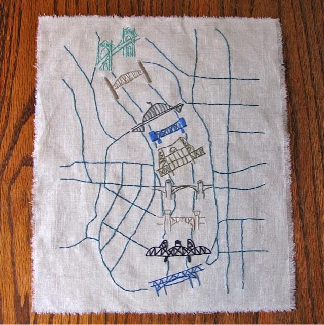
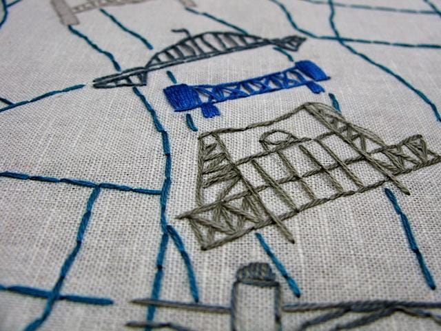
I make embroidered maps of all kinds (because why not combine travel and craftiness?) but while I've done some great ones of a few other cities, like Prague, Paris and Amsterdam, I still need a perfect Portland map. It's my hometown, after all!
Embroidery limits the detail I can put into maps a bit, and focuses it more on the lines and colors, so I want to make a really graphic, clear map. Since one of Portland's nicknames is Bridge City, and since there are so many great bridges crossing the Willamette, I might use those designs as a way to try out some new stitches.
A really rough sketch of all the bridges over the river:
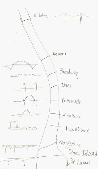
I could either do them all in classic black... or grays and blues to reflect the Portland weather. Or maybe go opposite and do neons! The bridges will need to be a bit bigger to be able to see the stiches better.
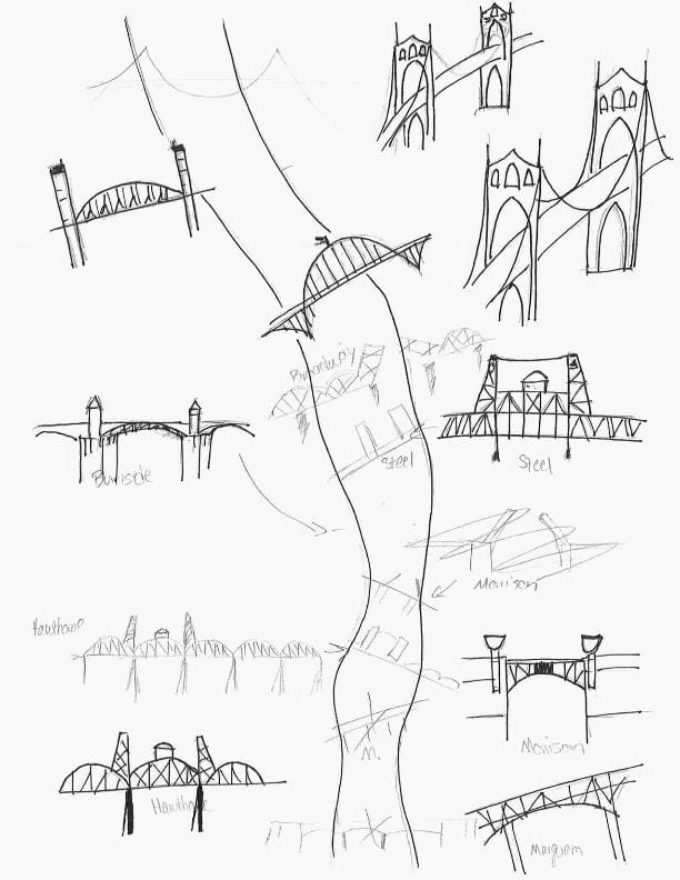
March 6: A second rough draft of a the bridges in more detail. Once I get them how I like them I'll transfer them to another sheet and place them better. I like drawing but I don't consider myself much of an artist--I look and copy, and use a simple mechanical pencil and a fine point sharpie. The drawing style works for embroidery--really simple lines and clear shapes.
My mappy inspiration: http://pinterest.com/katriniella/lovely-maps/
I fall hard for sweetly illustrated maps of any kind!